Whenever I search for a new destination, my main goal is to explore natural environments. That’s how I discovered Crete’s highest mountain, Mount Ida. Also known as Psiloritis, this mountain range is located in the centre of Crete, specifically in the Rethymno region. With its highest peak, Timios Stavros, rising to 2,456 meters (8,057 feet) above sea level, it became even more enticing to conquer.
Greece isn’t only famous for its breathtaking landscapes, but also for its captivating mythology. One such myth is Mount Ida, a place where the legendary Zeus, ruler of gods and men, is said to have been born. Interestingly, a mountain in northwestern Turkey bears the same name: Ida. Moreover, it’s fascinating how history and myths intertwine in these ancient lands.
This blog article is your entrance to an exciting adventure as we explore the journey from Mygero shelter to the pinnacle of Mount Ida. A hike that guarantees both breathtaking scenery and a profound attachment to the core of Crete.
How to get to the Mygero Refuge?
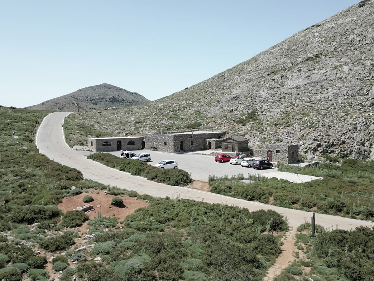
The best way to reach the Mygero hut is by car. Simply enter the coordinates “6QRH+J3 Kouloukonas, Greece“, into your GPS and follow the route to the starting point of your hike. The road to the refuge is generally in good condition and offers stunning surroundings, but expect some narrow sections.
Note that the car park at Mygero Hut has limited capacity but is free. Although the hut itself is not in use, you can use the car park as a starting point. From there, cross the road and start your hike to the highest point of Crete.
Mygero Refuge to Mount Ida
Mount Ida hike details:
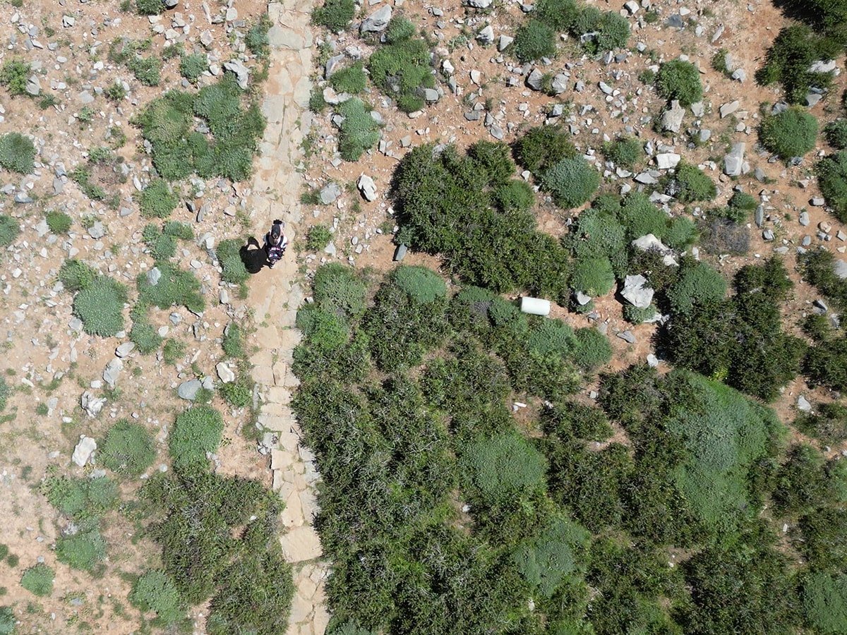
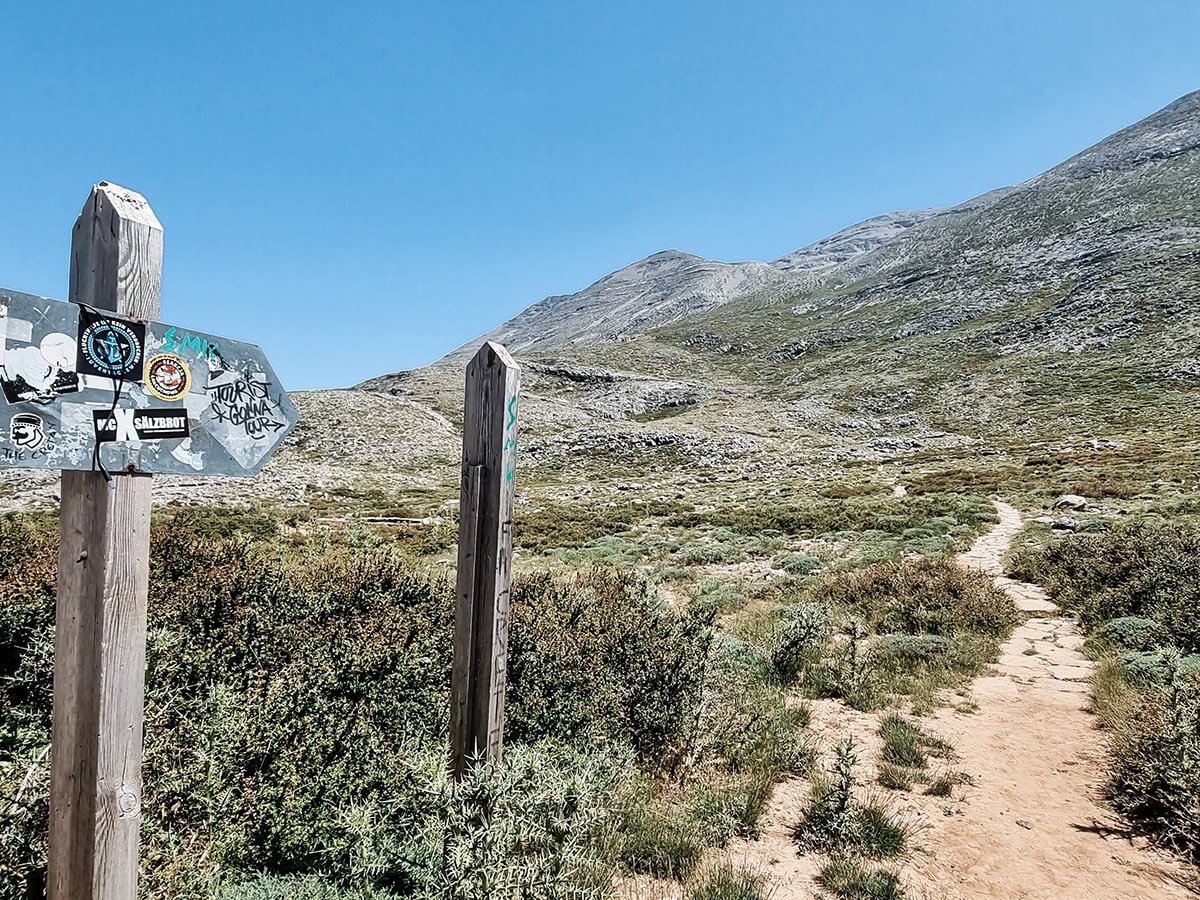
The below details refer to an out-and-back hike. The trail is marked with poles at the beginning and later on with red dots.

Distance
.svg)
Duration
.svg)
Difficulty

Ascent
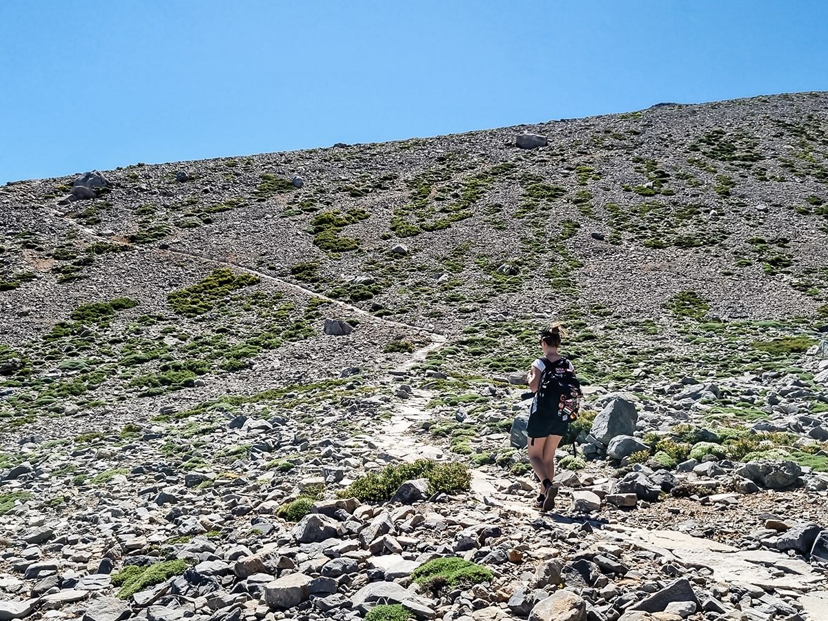
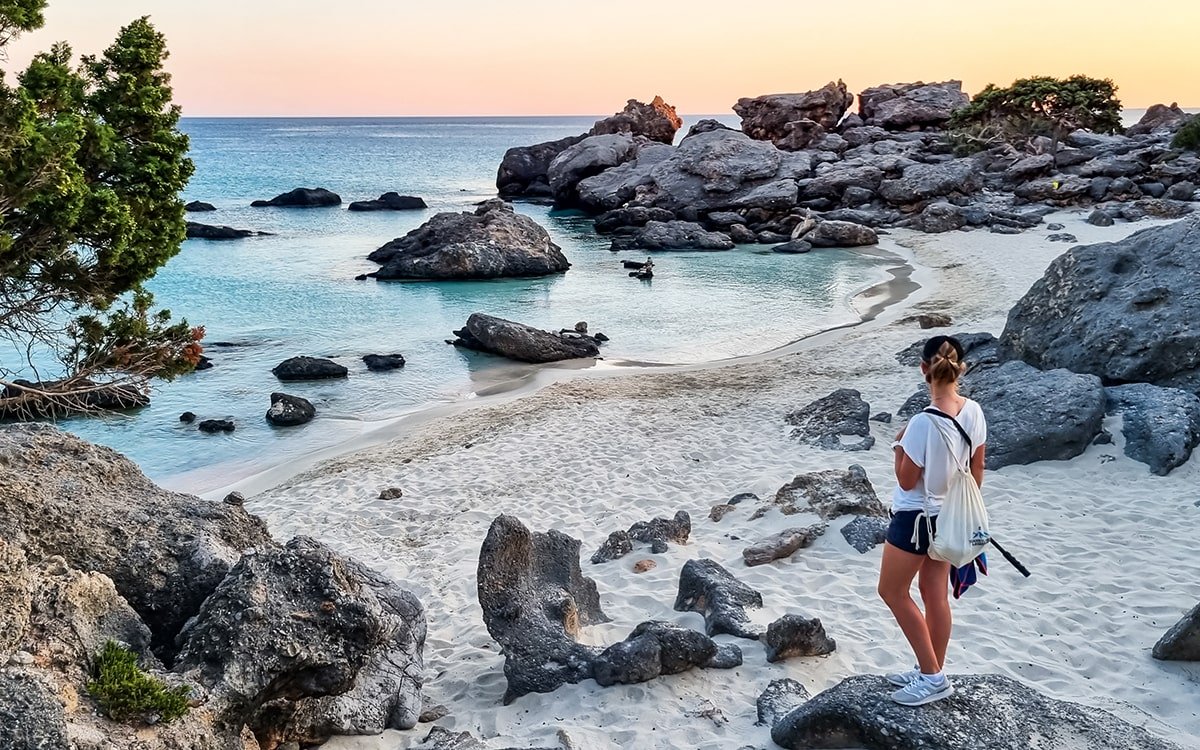
A Scenic Hike in Crete
Having arrived at the car park, the hike can begin. Once you cross the road, a sign points to the path. In the beginning, the path becomes slightly steeper. We started our hike around 10 am, in June. Although we were up in the mountains, the weather was still warm, but don’t forget to bring a windbreaker when you get to the top. Also, don’t be surprised if you encounter kri-kris, sometimes called Cretan goats, along the way. These animals are everywhere in Crete, especially in the mountains.
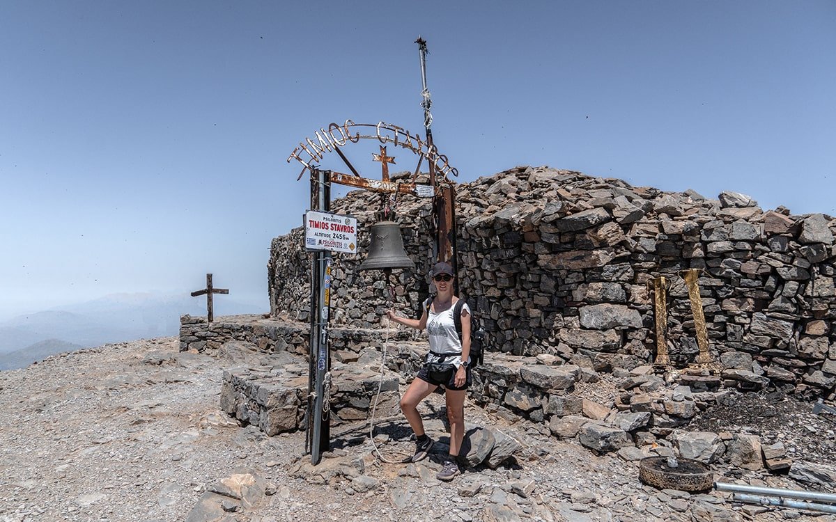
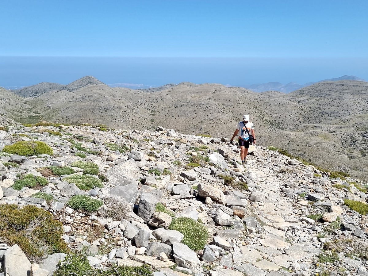
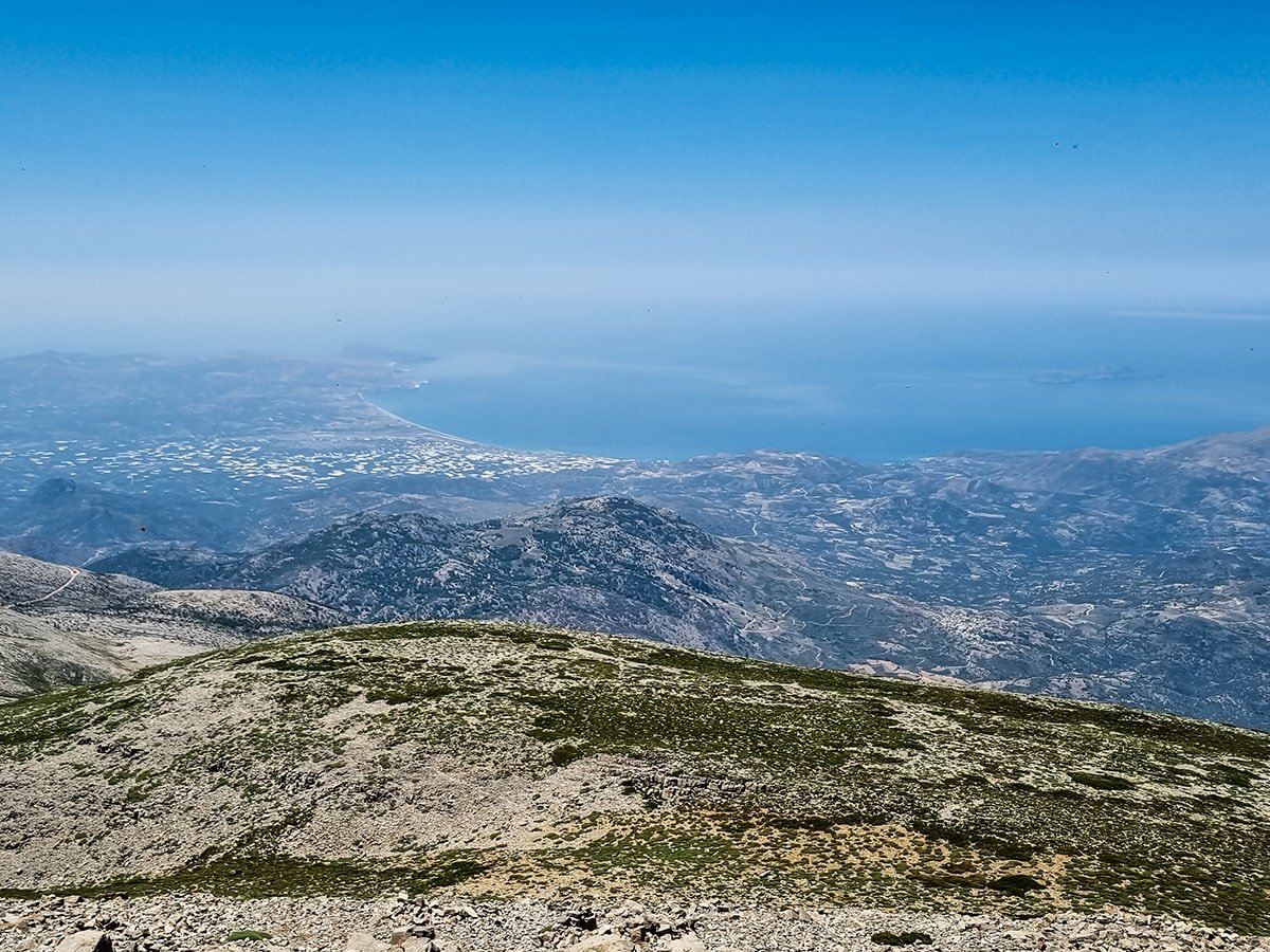
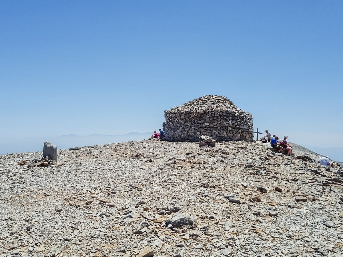
A Breathtaking Summit
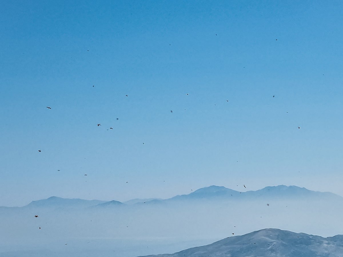
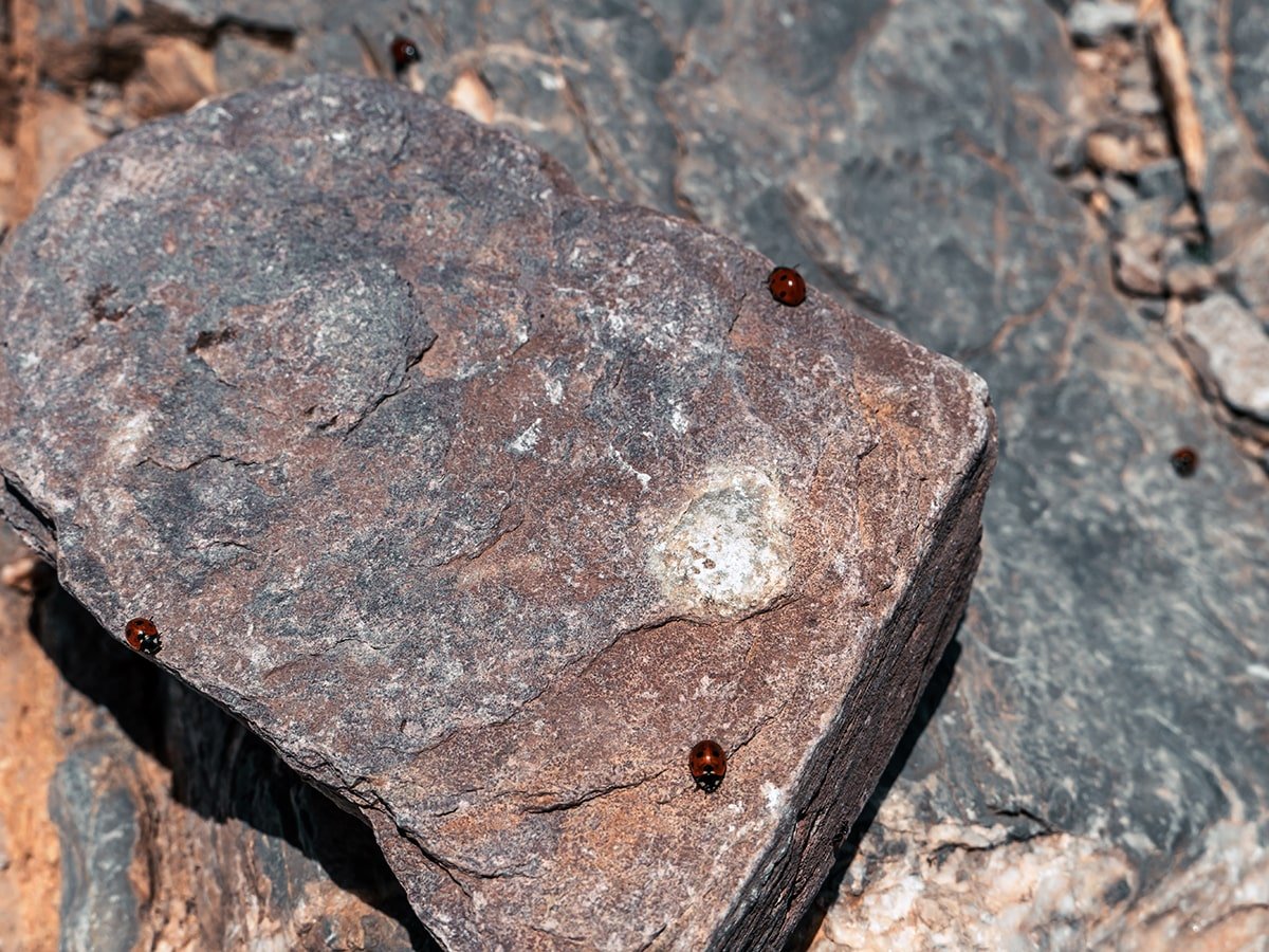
The path remains steep and the terrain is mostly surrounded by rocks, with some vegetation. But not only the rocks but also the surroundings reveal their beauty with increasing altitude. The higher you get, the better the view. You will see some mountain ranges, settlements and also the sea. What was different again from other hikes I have experienced is that we encountered hundreds of ladybugs on the summit. Zurely it’s seasonal, but there were ladybugs with every step you took. Sometimes they even became annoying when you tried to eat something. However, as you continue on, the breathtaking view of the surroundings and the charming chapel constructed from rough stones will make you forget about any earlier inconveniences.
What should you bring with you on the hike to Mount Ida?
Although it depends on the time of year you want to climb the summit of Crete, it is good to be prepared. However, in summer light clothing is sufficient only a windbreaker over the summit might be necessary. Otherwise, dress in layers to be comfortable at any time of the day.
These things should be on your hiking checklist:
- Backpack
- Rain jacket/trousers
- Hiking boots
- Warm clothing
- Plenty of water
- Plenty of food (snacks, energy bars, sandwiches, fruit, etc.)
- Sunscreen/sunglasses
- Camera
- Headlamp/torch
- Knife or multi-tool
If you are seeking a great outdoor activity, then hiking Mount Ida might be ideal. Furthermore, it provides a good workout with amazing views.
2 responses
Ik heb geen gps maar via welke plaatsen kan ik De berghut bereiken ,vorig jaar ging ik via Anogia , toen kwam ik uit bij de verkeerde punt bij een grot van zeus. Waar nog een rails naar binnen liep, ik rijd vanaf het noorden , kunt u mij helpen welke route er naar toe, alvast bedankt
Hello Eddy
If you’re coming from the north, the best route to Mygero Refuge is through Anogia. However, you likely took the road leading to Ideon Cave instead of the one toward the refuge last time.
This time, after reaching Anogia, continue toward Zoniana and then head south toward Livadia. Once in Livadia, look for signs pointing to Mygero Refuge. The road is mostly in good condition but can be narrow in some parts.
If you’re unsure along the way, I recommend asking locals in Anogia or Livadia, they are familiar with the route and can guide you. Let me know if you need more details!