If you’re planning a hike to Pietrosul Rodnei Peak in Northern Romania and seeking details on where to start and what to expect, this article is for you. Standing at 2,303 meters (7,556 feet), Pietrosul Rodnei is the highest peak in the Rodnei Mountains and the Eastern Carpathians. Along the way, hikers encounter the breathtaking alpine beauty of Lake Iezer, stunning views, thrilling trails, and the natural splendour of Romania’s mountainous terrain.
Table of Contents
Where is Pietrosul Rodnei Peak and How to Get There?
Pietrosul Rodnei Peak is within The Rodna Mountains National Park, a protected area in Northern Romania. The park is nestled within the Rodna Mountains, part of the Eastern Carpathians.
Getting There by Car
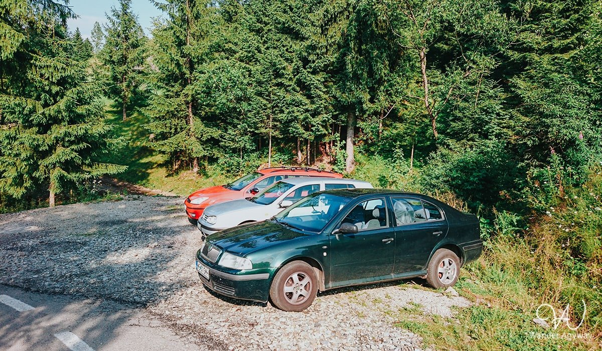
If you are arriving in Borșa by car, look for Avram Iancu Street. The hike to Pietrosul Rodnei Peak begins from this street in Borșa. However, if you’re driving, you can save time by continuing an additional 4 km to either of these points: first point or second point. These points serve as starting points for the hike to the peak. Whichever route you choose is suitable, as they eventually converge and follow the same path.
Getting There by Bus
Reaching Borșa by bus is also possible with numerous services available from several cities. Depending on your departure city, I recommend checking the Rome2rio website for options. It provides detailed information about bus services from various departure cities, including FlixBus and other local providers.
Getting There by Train
There is no direct train option to Borșa. The closest train station is in Săcel, from where you will need to take a bus or taxi to reach Borșa. You can check the train schedules here.
Hiking Details and Starting Points
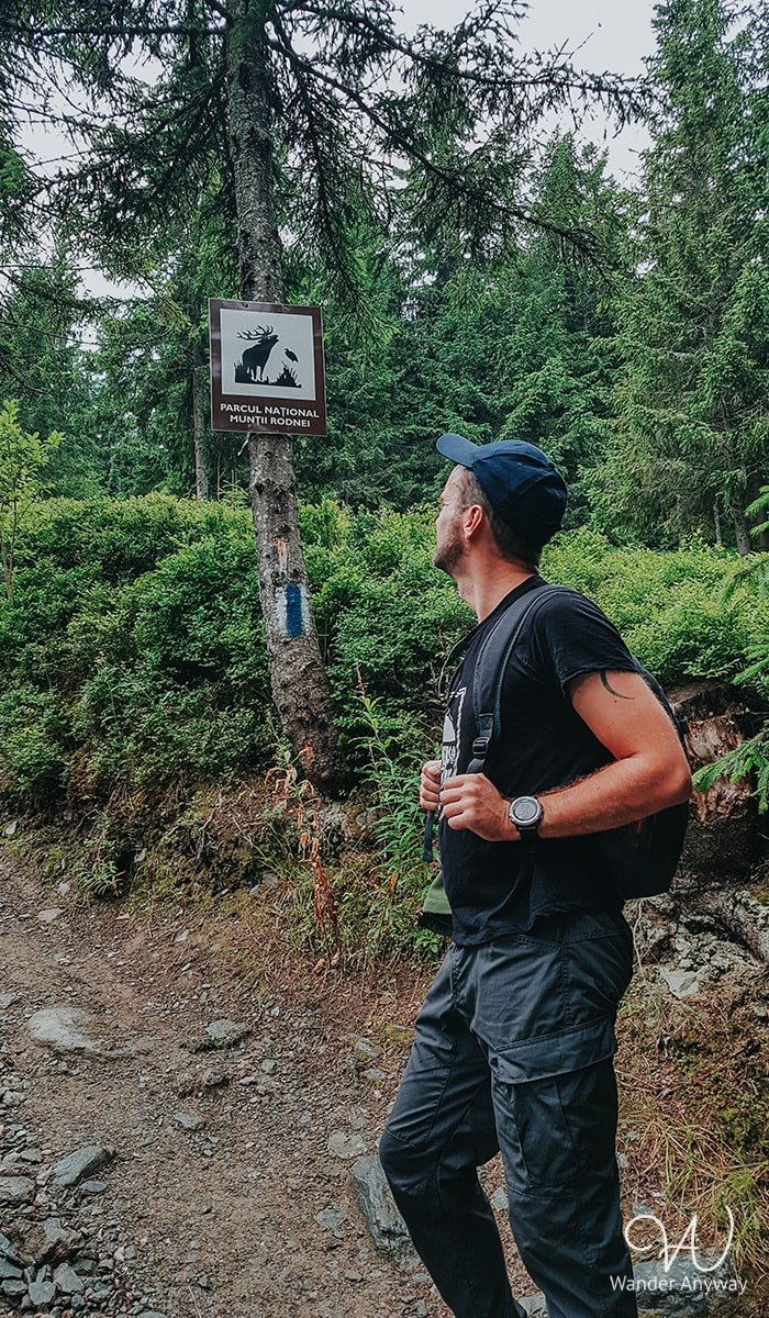
There are three well-known starting points for hiking Pietrosul Rodnei Peak. The most common begins directly from Borșa, specifically from Avram Iancu Street. However, if you come by car, you can save yourself 4 km by driving to either of these points: first point or second point. I chose the latter and started my hike from there. Both routes eventually merge and continue along the same path.
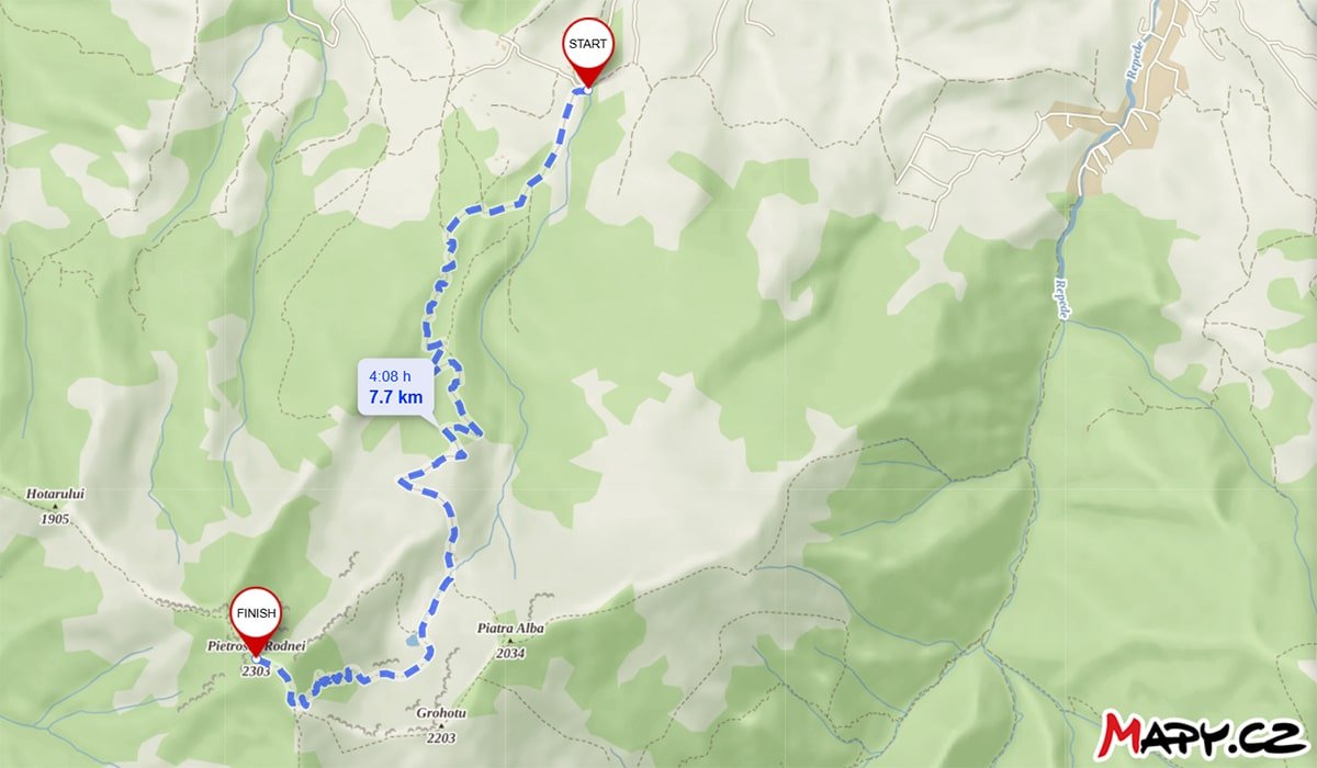
Follow the blue stripe on the white background for this hike. The following details are for an out-and-back hike from this starting point.

Distance
.svg)
Duration
.svg)
Difficulty

Ascent
Hiking Experience (Pietrosul Rodnei)
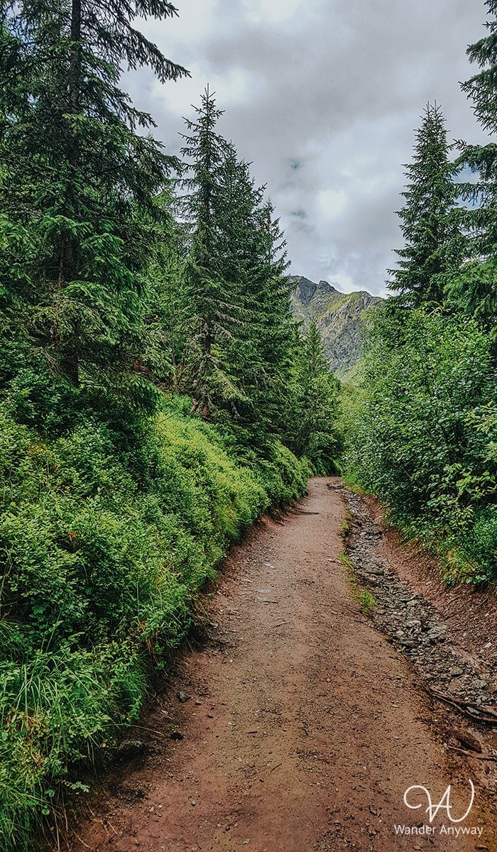
Parking Lot to Meteo Station
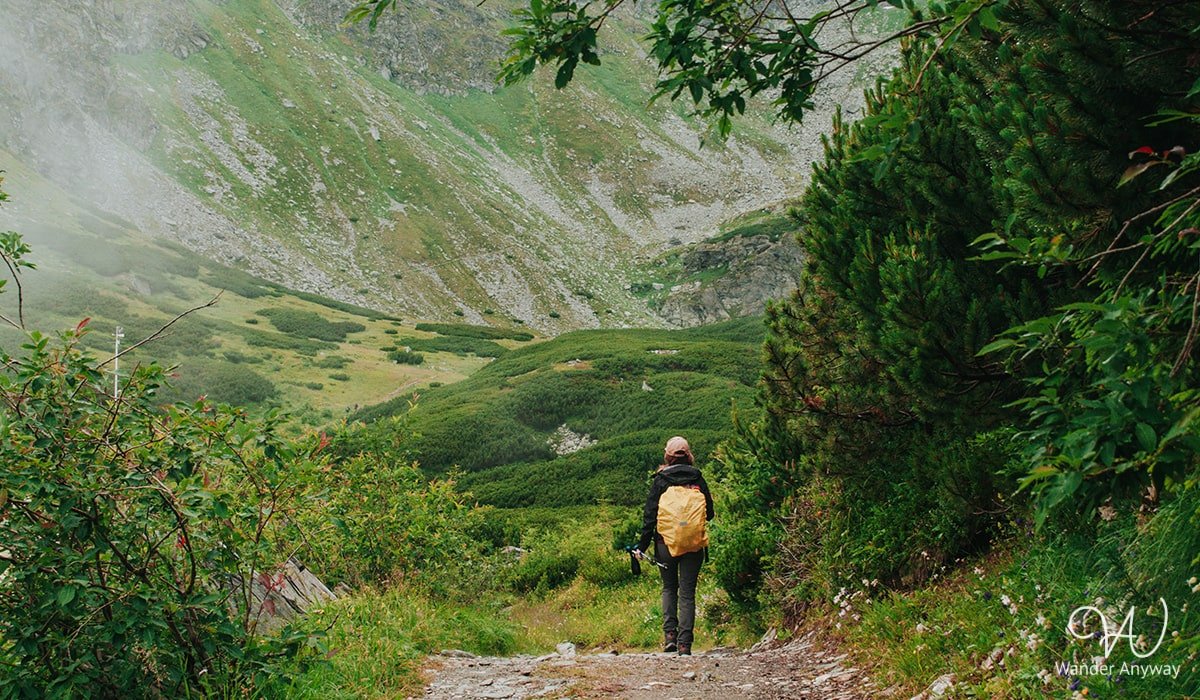
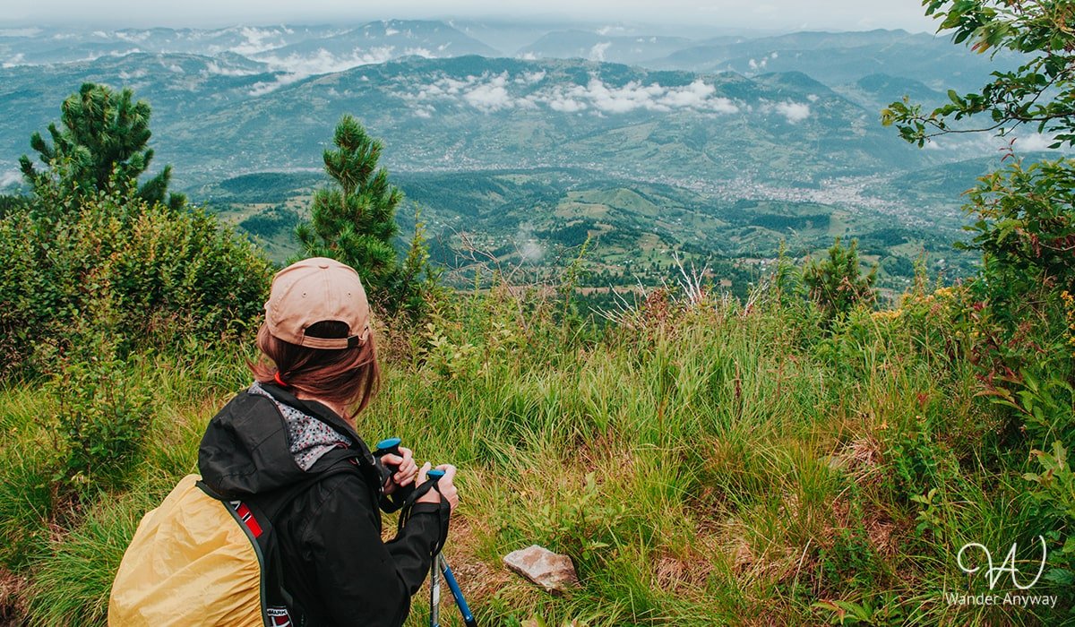
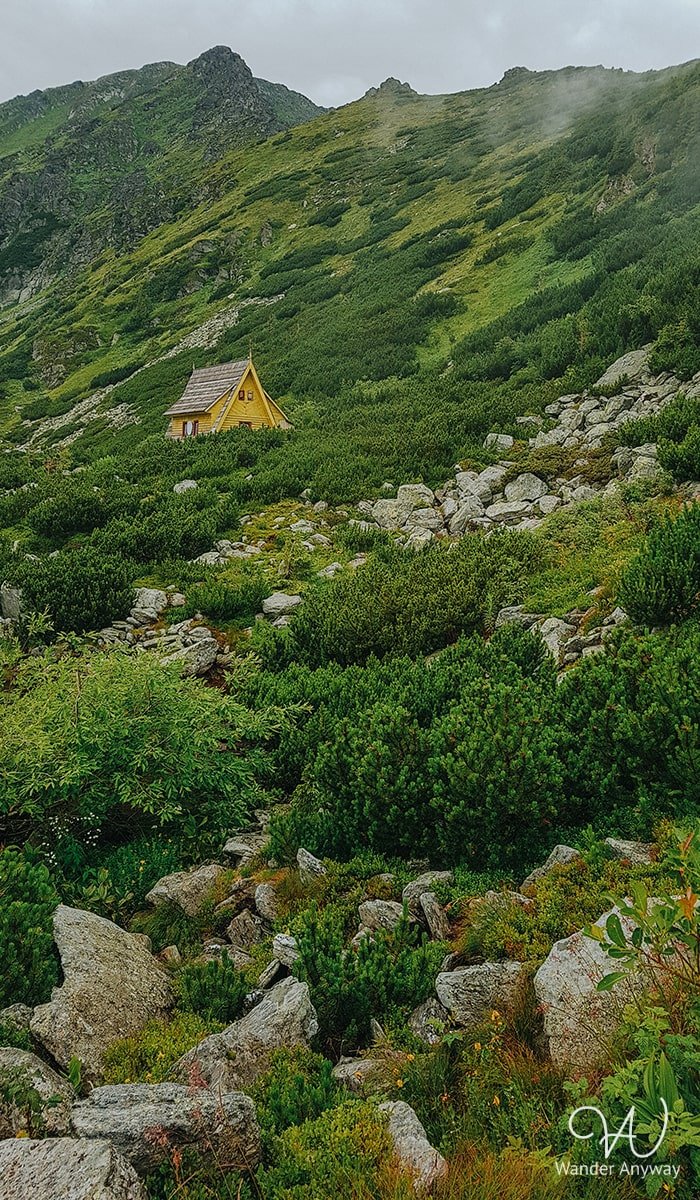
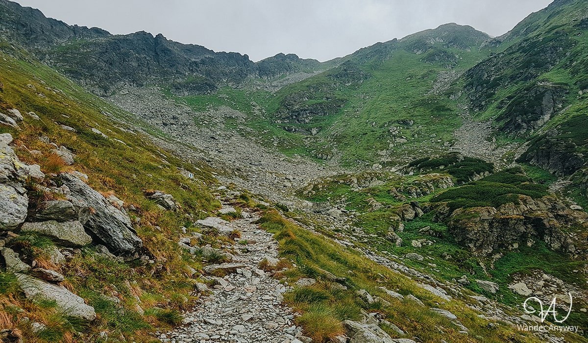
We started our hike on a Sunday morning in July, not too early, around 9 a.m. The weather was nice, a bit cloudy. The path is more like a forest road with rocks here and there, sometimes surrounded by trees and other times by lush greenery. As we climbed higher, the views improved. With good weather, you can see the surrounding mountains and towns.
Consequently, we continued at a slow pace because you couldn’t hurry when going uphill, and there was no need to rush. The weather was pleasant, the views were beautiful, and it wasn’t crowded. We only met a few other hikers on the path.
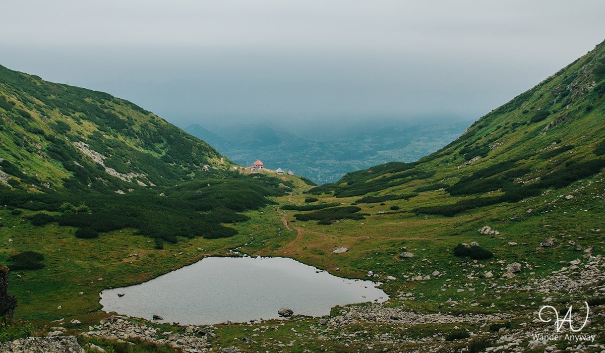
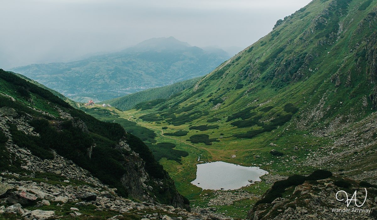
Meteo Station to Lake Iezer
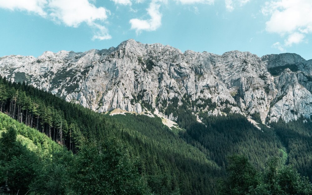
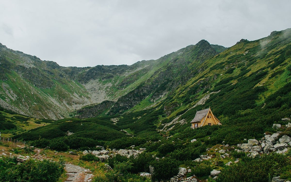
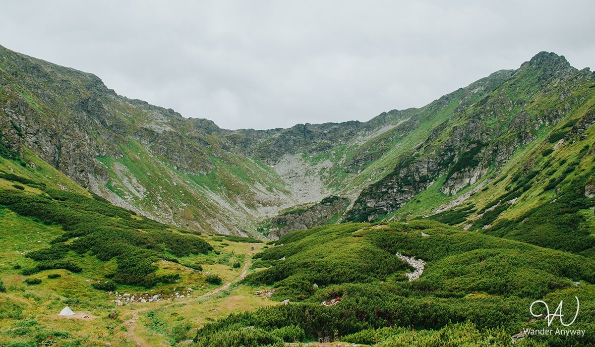
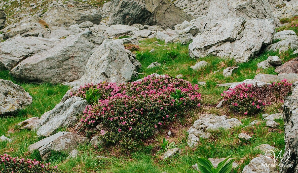
After several kilometers, we finally reached the meteorological station where the landscape changes. There were no trees, just a beautiful green valley with flowers and peaks. From here, the hike towards Lake Iezer is relatively flat. At the lake, we took a lunch break and enjoyed the views before tackling the zigzag hike. Lake Iezer is a glacial lake located in the Rodna Mountains, below Pietrosu Peak, at an altitude of 1,825 meters. It has an area of 3,450 square meters, a maximum depth of 2.5 meters, and a length of 84 meters. Swimming is not allowed.
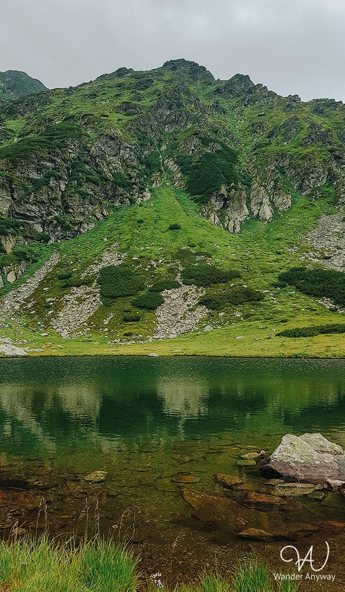
Interestingly, the lake’s shape resembles the map of Romania, although this is only visible from a higher altitude. You will see this yourself as you continue your hike to Pietrosul Rodnei Peak.
Lake Iezer to Pietrosul Rodnei Peak
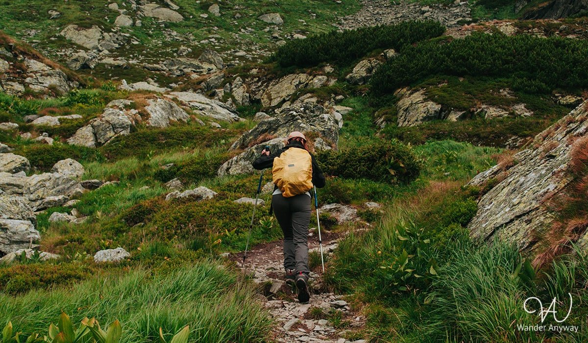
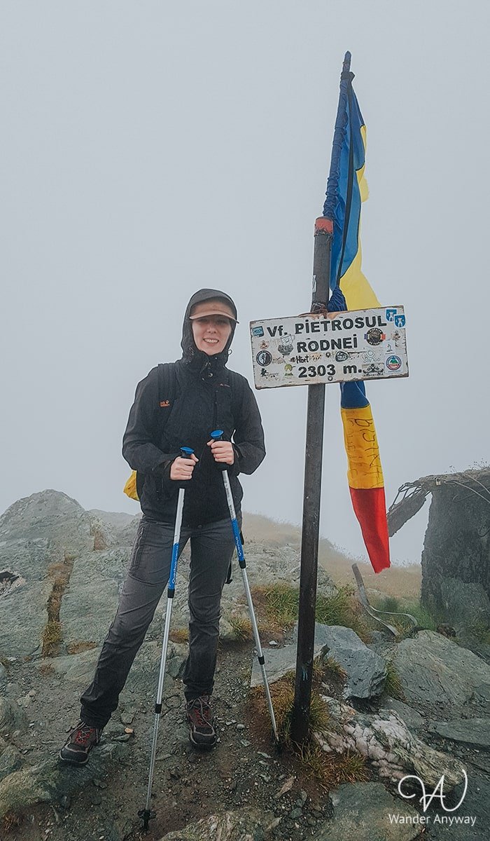
After our break, we continued towards the peak. The weather quickly changed, sometimes with light rain. The zigzag hike takes quite some time, but at least the breaks offer stunning views. We reached the peak, but unfortunately, the weather was not on our side. It was so cloudy and foggy that visibility was minimal, and it started to rain. So, we didn’t spend much time at the top.
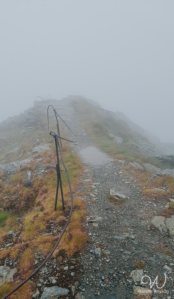
As we started descending, we looked for shelter and took a break, hoping the clouds would clear so we could climb back for better views. Sometimes you’re lucky, sometimes you have to continue your path. The weather didn’t seem to change. As we reached lower altitudes, the rain stopped, but looking back at the peaks, they were still covered in clouds. Consequently, we abandoned the plan to go back that day and made plans to return another time.
When to Hike Pietrosul Rodnei Peak
You can hike Pietrosul Rodnei Peak during any season. However, winter hiking is only recommended for those who are well-equipped and experienced, and when the weather conditions are favorable. The best times to hike are after the snow has melted and there are no avalanche risks. Always check the weather before your hike. The ideal seasons are late spring, summer, and early autumn when the weather is most accommodating.
Tips for Hiking Pietrosul Rodnei
- Check Weather Conditions: The weather in the mountains can change rapidly. Make sure to check the forecast and prepare for sudden changes.
- Wear Appropriate Gear: Good hiking boots, weather-appropriate clothing, and a map or GPS device are essential.
- Start Early: Begin your hike early in the morning to ensure you have plenty of daylight.
- Stay Hydrated and Bring Snacks: Carry enough water and food to keep your energy up during the hike.
- Bear Spray: For safety in case you encounter wildlife.
- Whistle: A whistle is essential for emergencies, allowing you to signal for help if needed. It can also be useful for keeping animals away or at least alerting them to the hiker’s presence, reducing the chance of surprising the animal.
- Headlight/Flashlight: Essential for early morning starts or if you’re hiking late.
- Knife or Multi-tool: Useful for various situations you might encounter on the trail.
- Sunscreen/Sunglasses: Protect yourself from the sun’s rays at higher altitudes.
- Camera: Capture the beautiful scenery and memorable moments.
- Notify Someone of Your Plans: Inform someone of your hiking route and your estimated return time.